
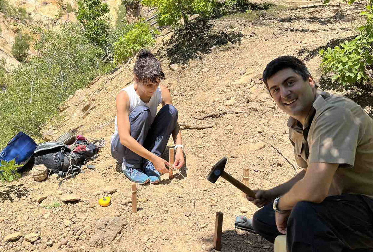
Featured image: team members, prof. Mileva Samardžić-Petrović & Uroš Đurić are marking the positions for corner reflectors
Site visit No. 2 was conducted to execute critical surveying and imaging tasks as part of ongoing efforts to enhance geospatial data collection and analysis. The objective of this fieldwork was to establish precise locations for corner reflectors, perform UAV photogrammetric imaging, and carry out geodetic surveys using GNSS receivers for static measurements.
Day 1: Arrival and Initial Surveying
Upon arrival, the team focused on identifying and marking appropriate locations for corner reflectors. These reflectors play a vital role in remote sensing applications by providing stable reference points for high-precision geospatial analysis. In addition, UAV photogrammetric imaging was performed to capture high-resolution aerial data, which is crucial for mapping and monitoring terrain changes. Simultaneously, geodetic surveys were initiated using GNSS receivers, applying the static method to ensure accurate and reliable positioning data.
Day 2: Completion of Geodetic Surveys
The second day of the fieldwork was dedicated to continuing geodetic surveying efforts. The team successfully completed the static method of GNSS surveying, further strengthening the accuracy of geospatial datasets. The collected data will be instrumental in supporting future research and monitoring activities.
This field visit marks a significant step in achieving comprehensive and precise geospatial data acquisition, contributing to the project’s broader scientific goals.